Page Contents
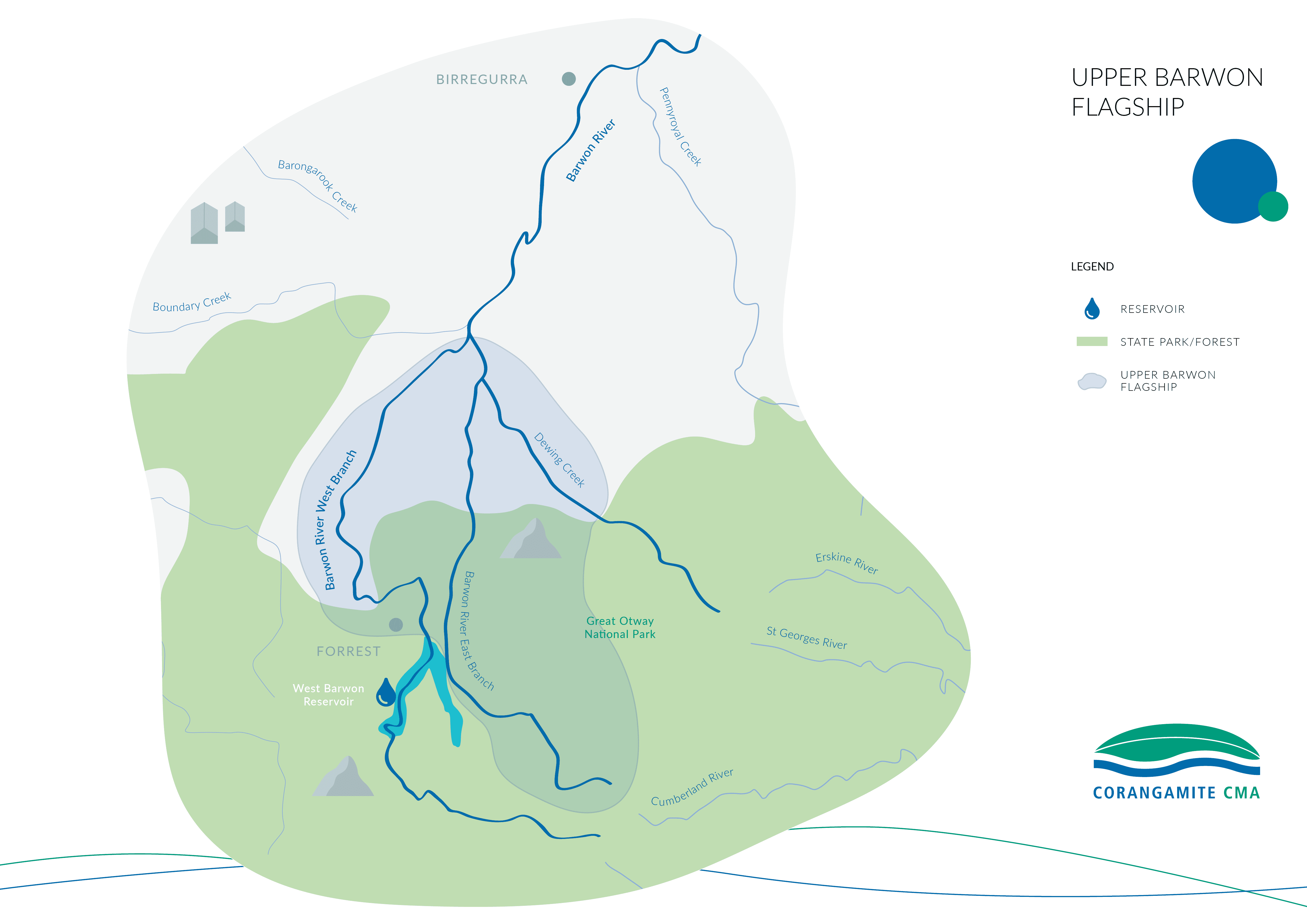
The Barwon River rises in the Otway Ranges and flows close to the townships of Forrest, Birregurra, Winchelsea and Inverleigh, before joining the Moorabool River and flowing through Geelong and the Lower Barwon Wetlands, joining the coast at Barwon Heads. The Barwon River flows through Eastern Maar Country and Wadawurrung Country.


The Corangamite Catchment Management Authority (CMA) has identified the Upper Barwon River as the focus for investment as part of our Barwon Flagship Waterway project. Flagship waterways are large-scale rehabilitation projects happening across the state of Victoria, made possible through the Victorian Government’s investment into waterway and catchment health.
The Barwon River was identified in Water for Victoria (2016) as a priority waterway within the region. This project is consistent with the Barwon Ministerial Advisory Committee (Barwon MAC) discussion paper and Corangamite Waterway Strategy, through contributing to social, economic, and environmental long-term outcomes.

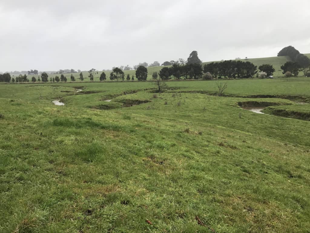
The Barwon Flagship project will be delivered as a large scale, long-term (30 year) project, with the Upper Barwon prioritised due to the significant impact of Willows (Salix spp) and Reed sweet Grass (Glyceria maxima) in the river system. This causes choke points that inhibit water flow and contribute to flooding. There are also impacts on riverbank stability and water quality due to unrestricted stock access.
A shared vision was created through community consultation in 2022:
By 2050, through working together to apply effective riparian management, sufficient environmental flow regimes will have been returned to the upper reaches of the Barwon River.
This will enable the river to support healthy, native vegetation and biodiversity, both instream and along its banks and provide habitat to a range of important local species, including platypus, native fish, and invertebrates, as well as providing benefit to downstream reaches.
The Upper Barwon’s many values will be appreciated, enjoyed, and cared for by landholders, Traditional Owners, citizen scientists and recreational users.
A Waterway Management Plan has been developed to guide the flagship project towards the 2050-vision. View the full and summary versions below:
During 2022 – 2024 the initial focus of the Flagship Project is about working together with landholders, key agencies and community groups to develop and trial strategies that can be applied to priority Willow and Glyceria chokes using riparian management practices. This will improve the delivery of environmental water within the Upper Barwon and further down the Barwon River.
A series of interconnected projects are being delivered to improve the health of the waterway. These are described below and have been designed to address the issues in this part of the system.
Flagship Waterway projects are one of the actions supported by the Rivers of the Barwon (Barre Warre Yulluk) Action Plan.
The Corangamite CMA's ‘E-Water’ team has been working towards improving the Upper Barwon River's flow using strategic water releases of water from the West Barwon Reservoir into either the East or West Branch of the Barwon River.
Through this we are aiming to improve flow in the river and water quality to maintain riverine habitat and food sources for native fish and platypus.
Water for the environment priorities in the Upper Barwon River:
The current environmental water entitlement held in the West Barwon Reservoir can only provide environmental water to the Upper Barwon east branch, the Upper Barwon west branch, with diminishing effect to reaches downstream in the main Barwon River channel. Listed above are the priorities for delivery from highest to lowest. There is insufficient water in the current entitlement to deliver them all, however they are all important. In addition to these priorities the upper east branch is prioritised over the upper west.
For live flow data information explore the Upper Barwon interactive map here.
Learn more about what the ‘E-Water’ team does here.
Riparian land is the ‘buffer zone’ between water and land. The land could be used for anything from a recreation reserve to an area for livestock to graze. It’s important to keep riparian land healthy and well covered with vegetation to help maintain a healthy waterway.
The focus areas for riparian works in the Upper Barwon is documented in the Corangamite Waterway Strategy and includes Dewing Creek and the Barwon River East and West branches to their confluence.
Previously, the Corangamite CMA has financed waterway protection and restoration works through the Waterway Protection Program which has funded works in Dewing Creek and the Barwon River in Birregurra.
A new model is being trialled for the East and West branch of the Barwon River with project requirements being different to the past. Find out more here.
This new program, 'Upper Barwon Flagship Riparian Works', will focus on trialling site specific riparian and on-stream innovative approaches to address the infestation problems with willows and Glyceria.
Learn more about the Waterway Protection Program here. Further updates on the trials will be included on this page.
Citizen Science aims to maintain and improve the connections between people and their local waterways. Corangamite CMA is supporting WaterWatch volunteers to conduct short and long-term monitoring in the Upper Barwon Flagship area.
The monitoring undertaken is used to help inform decisions regarding the future management of the river. There is a strong focus on assessing water quality through the monthly water testing program on the East and West branches as well as the main Barwon channel from Forrest through to Winchelsea.
Seasonal waterbug surveys are done in spring and autumn to provide a picture of waterway health that can be used to monitor change in the environment associated with restoration activities and delivery of water for the environment. This information is publicly available at the WaterWatch Portal and National Waterbug Blitz Portal (click on the interactive maps in the portals to find Barwon Flagship data).
If you would like to get involved in a volunteer program click here, to register your interest.
Also check the Corangamite CMA Events page to participate in upcoming events such as Waterbug Discovery Days.
The Corangamite CMA works in partnership with a number of agencies and Landcare groups to deliver works within the Upper Barwon area.
Barwon Water is Victoria’s largest regional urban water corporation. It services a population of more than 320,000 people, which rises to more than 545,000 people in peak periods.
Find out more about their work on the Upper Barwon River here: Forrest community hub | Your Say Barwon Water
Upper Barwon Landcare Network is made up of 7 Landcare and Farmcare groups in the mid and upper Barwon River catchments upstream of Inverleigh to the northern foothills of the Otway Ranges in South West Victoria. Comprising of over 153,000 hectares, the area includes parts of the Surf Coast and Colac Otway Shires.
Arthur Rylah Institute for Environmental Research conduct applied ecological research with an emphasis on plants, animals and biodiversity issues.
In the Spring and Summer of 2021, as part of a PhD project, Mariah Sampson visited streams across the Upper Barwon Catchment to collect data on water quality, in-stream vegetation, vegetation in the riparian zone, and channel morphology measurements.
The sites visited consisted of riparian vegetation that was either dominated by willows, replanted native vegetation, or a thin strip of blackwood. The sampling was designed to collect data for two research questions:
In 2022 Mariah returned to repeat the collection of data after the willows had been removed along the East Barwon River. The goal of this sampling was to determine whether the removal of the willows has started to influence water quality, in-stream vegetation, and channel morphology.
This is an exciting area of research as there are few studies that investigate the immediate impacts of willow restorations on streams. The collection of data both before and after works is rare. The goal of this research will be to contribute supporting knowledge for future riparian restoration projects.
Enter your details below to subscribe to the Barwon Flagship E-Newsletter.
Barwon Flagship Community Update, June 2024
Barwon Flagship E-newsletter, Summer 2024
Barwon Flagship E-newsletter, Winter 2023
Barwon Flagship E-newsletter, Summer 2023
Barwon Flagship Community Update, November 2022
Barwon Flagship E-newsletter, Spring 2022
Barwon Flagship E-newsletter, Autumn 2022
Barwon Flagship E-newsletter, Autumn 2022
Upper Barwon Community Update 4
Upper Barwon Community Update 3
64 Dennis Street, Colac VIC 3250
PO Box 159, Colac, VIC 3250
Hours: 8:30am – 5pm, Monday to Friday
T: 1800 002 262
E: info@ccma.vic.gov.au
BARWON WATER OFFICES
Hours: 8:30am – 5pm, Monday to Friday
All mail must be sent via our Colac office
PO Box 159, Colac, VIC 3250
T: 1800 002 262
E: info@ccma.vic.gov.au
 Close
Close