

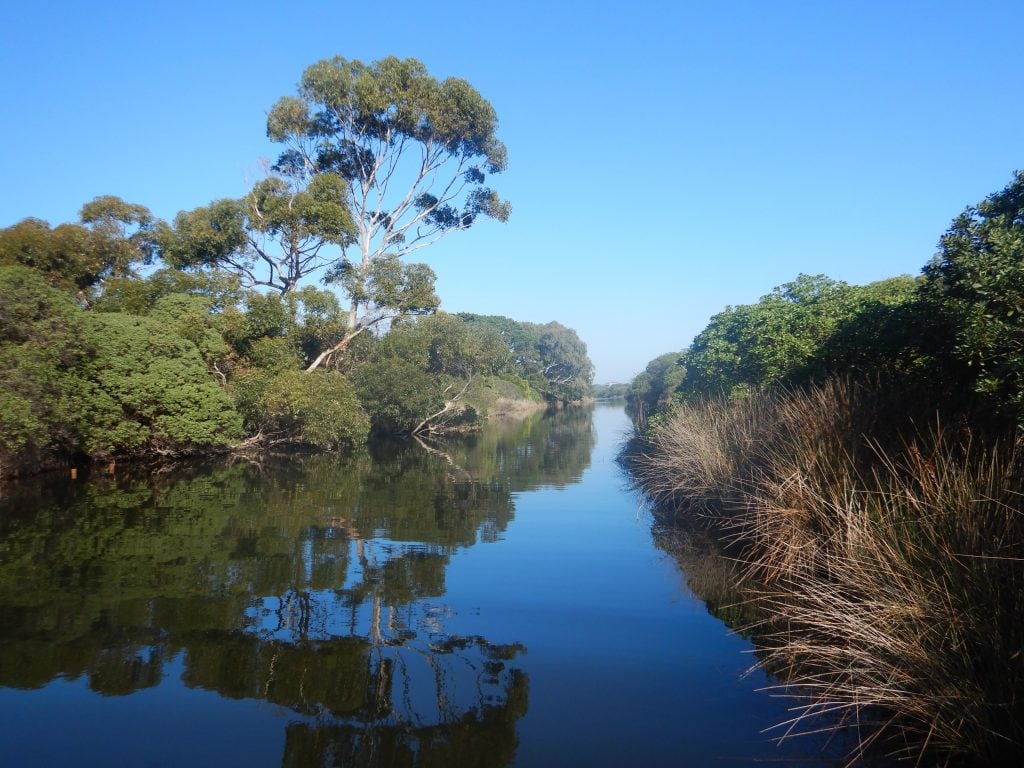
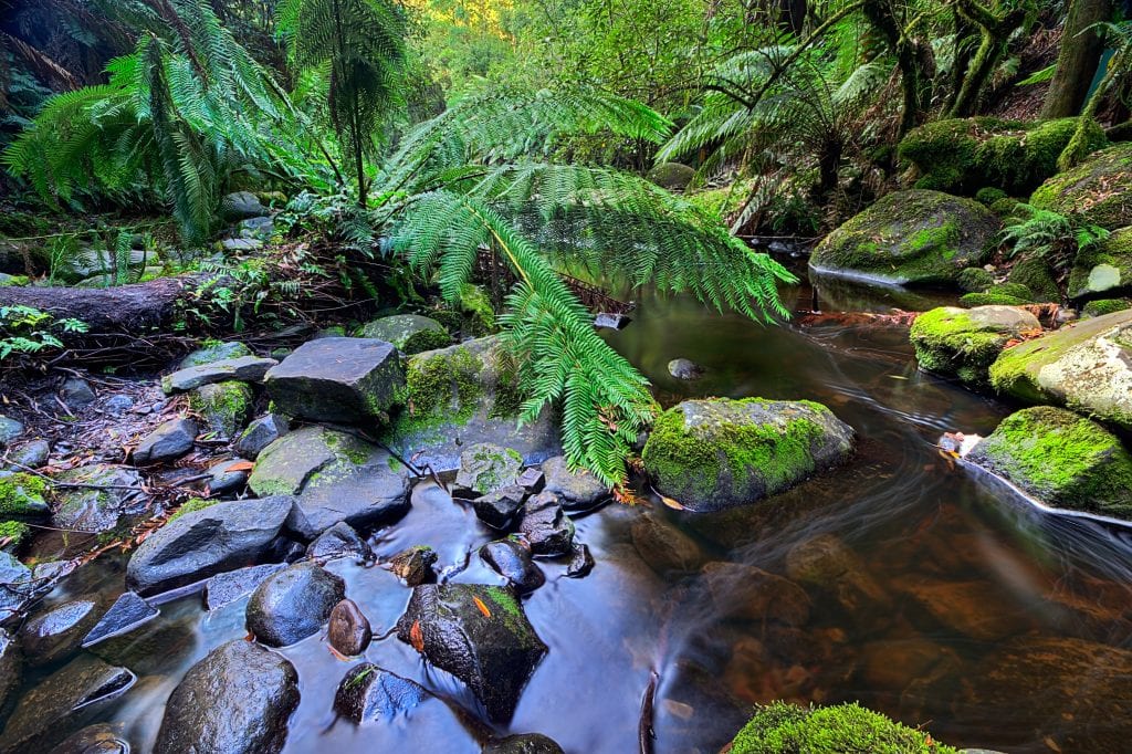
The rivers and streams of the Otway Coast are highly valued for their rich environmental values and strong cultural heritage. Whilst in good to excellent condition, they are vulnerable to threats from sea level rise, changes in rainfall and temperature, and the pressures of population growth and tourism.
The Surf Coast Otways Restoration project will protect the rivers and streams of the Surf Coast and Otways through supporting land managers to undertake and maintain on-ground restoration works, partnering with Traditional Owners to protect cultural heritage, and engaging the community via education, citizen science and volunteering.
The project covers the landscape from the Curdies River in the west of the region to Thompsons creek in the east. The area presents diverse landscapes and uses and is a popular tourist destination for national and international visitors.
The project will protect significant fish (Yarra Pigmy Perch and Australian Grayling), birds (riparian, estuarine and freshwater), aquatic invertebrates and vegetation, as well as the Heritage-listed Aire River.
This project is funded by the Victorian Government under the fifth tranche of the Environmental Contribution.
The City to Sea – Lower Barwon River and Ramsar Wetlands project includes the entire Port Phillip Bay (Western Shoreline) and Bellarine Peninsula Ramsar site, which covers 22,650 hectares and comprises six distinct areas that include Point Cook/Cheetham, Werribee/Avalon, Point Wilson/Limeburners Bay, Swan Bay, Mud Islands, and the Lake Connewarre complex.rnrnThe Port Phillip Bay (Western Shoreline) and Bellarine Peninsula Ramsar site provides an important feeding ground for migratory bird species. The Ramsar Convention is an international agreement for the protection of wetlands of international significance. This area was listed as a Ramsar site in 1982.rnrnThis significant system supports up to 300,000 shorebirds and waders from the northern hemisphere. It supports 12 threatened animal species, including the critically endangered Orange-bellied parrot, one threatened plant community and is important habitat for over 50 fish species.rnrnLearn more about Ramsar sites u003ca href=u0022https://ccma.vic.gov.au/project/ramsar-wetlands/u0022u003ehereu003c/au003e.rnrnu003cstrongu003eThe Port Phillip Bay (Western Shoreline) and Bellarine Peninsula Ramsar Programu003c/strongu003e will deliver the management strategies and monitoring requirements set out in the Ramsar Site Management and Monitoring, Evaluation, Reporting and Improvement Plan. This includes development and implementation of an Annual Action Plan in consultation with the Ramsar Site Coordinating Committee, monitoring and on ground works to maintain the site’s ecological character.
Past investment sites will be monitored using the DEECA Riparian Works Review, and management advice and/or funding provided to landholders to maintain weed control or supplement planting at revegetation sites, with funding prioritised to willow removal sites.
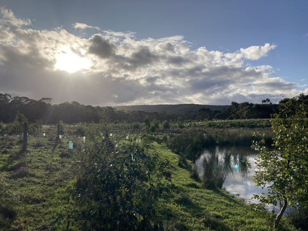
Working in partnership with Landcare groups, incentives will be provided to landholders for on-ground works (fencing, stock exclusion, installation of off-stream water, controlling weeds and willows, protecting remnant vegetation and revegetation), focusing on areas of known habitat for threatened native fish species (Yarra Pygmy Perch and Australian Grayling) on the lower to mid Curdies River and throughout the Otways and Surf Coast catchments.
Corangamite CMA field officers will facilitate on-site meetings between land managers and Traditional Owners to enable access to Country in culturally sensitive areas and provide two-way knowledge exchange.
Corangamite CMA will work in partnership with Conversation Volunteers Australia, Ozfish and Fishcare volunteers to engage local anglers and Traditional Owners in planning and undertaking instream habitat creation (using timber repurposed from Regional Roads Victoria projects), riparian habitat restoration and weed management at popular angling spots on the Curdies River.
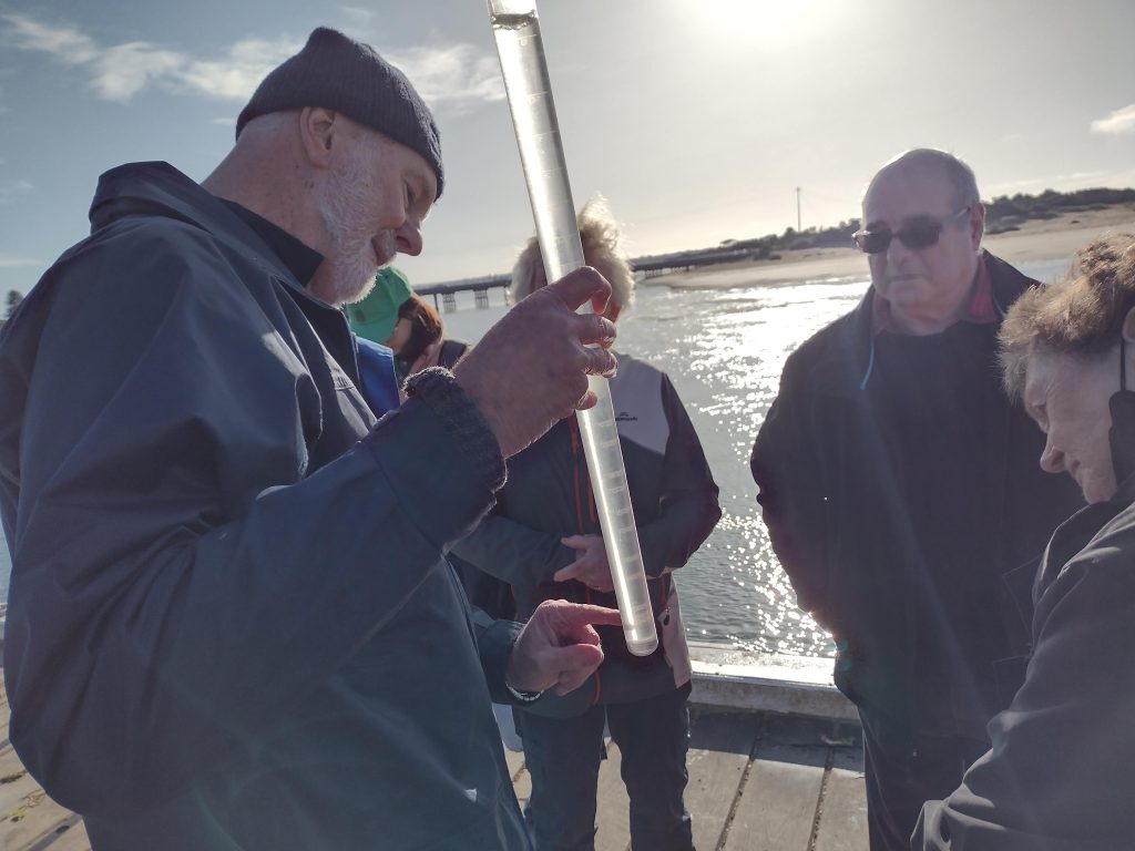
Citizen Science aims to maintain and improve the connections between people and their local waterways. This is undertaken through diverse hands-on activities, such as monitoring water quality, photopoint monitoring at key sites, or e-DNA sampling.
Corangamite CMA Officers support citizen scientists with site inspections and training to collect water quality monitoring data from Estuary Watch and Waterwatch sites selected to evaluate and support estuary management, on-ground works (including angler partnership activities) and environmental water delivery to Painkalac Creek, in partnership with local councils, Coastcare, Landcare Networks, Great Ocean Road Coasts and Parks Authority GORCAPA, Parks Victoria and Barwon Water.
The Wild Otways Initiative currently has projects being undertaken in the Surf Coast Otways Restoration project landscape.


64 Dennis Street, Colac VIC 3250
PO Box 159, Colac, VIC 3250
Hours: 8:30am – 5pm, Monday to Friday
T: 1800 002 262
E: info@ccma.vic.gov.au
BARWON WATER OFFICES
Hours: 8:30am – 5pm, Monday to Friday
All mail must be sent via our Colac office
PO Box 159, Colac, VIC 3250
T: 1800 002 262
E: info@ccma.vic.gov.au
 Close
Close