

The City to Sea – Lower Barwon and Ramsar Wetlands project will see the Corangamite CMA partner with landholders, Traditional Owners, agencies and the community to protect and improve the lower Barwon River and wetlands through the delivery of environmental water, monitoring and protection of threatened fish, on-ground and in-water restoration works, and engaging the community in citizen science and education.
Through this project the Corangamite CMA will also protect and maintain the values of Port Phillip Bay (Western Shoreline) and Bellarine Peninsula Ramsar Site, which is home to a rich diversity of wildlife.
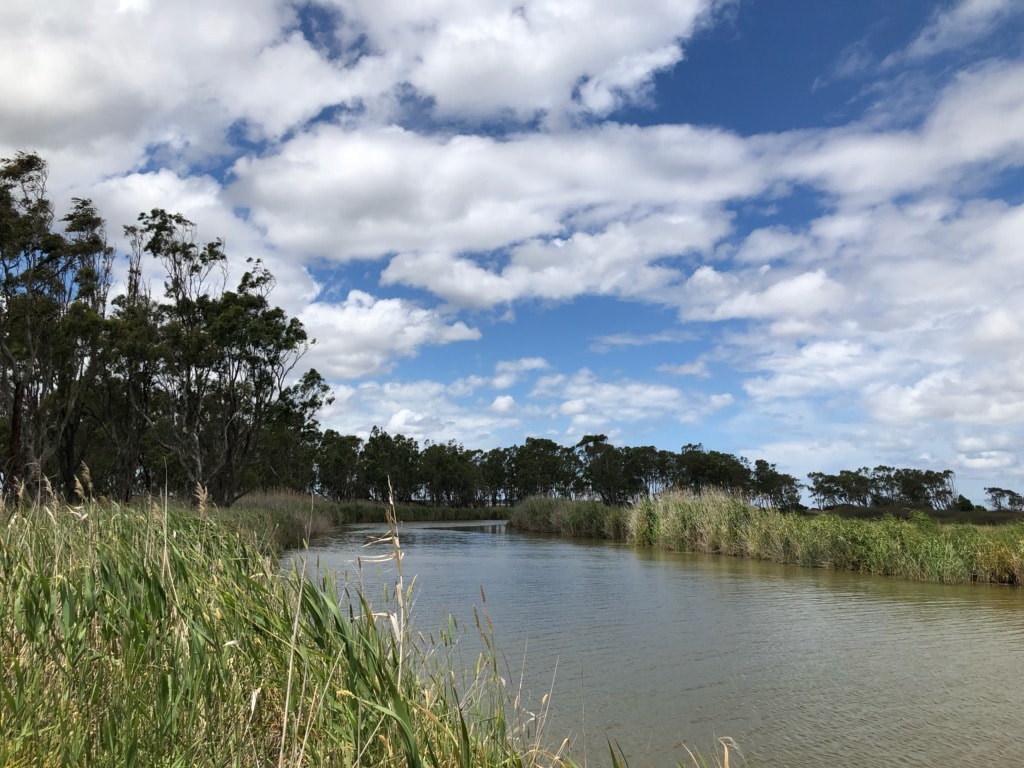
The project area includes the internationally significant Port Phillip Bay (Western Shoreline) and Bellarine Peninsula Ramsar site, the mid to lower Barwon River and along Waurn Ponds Creek, to the estuary mouth at Barwon Heads.
This project is funded by the Victorian Government under the fifth tranche of the Environmental Contribution.

The City to Sea – Lower Barwon River and Ramsar Wetlands project includes the entire Port Phillip Bay (Western Shoreline) and Bellarine Peninsula Ramsar site, which covers 22,650 hectares and comprises six distinct areas that include Point Cook/Cheetham, Werribee/Avalon, Point Wilson/Limeburners Bay, Swan Bay, Mud Islands, and the Lake Connewarre complex.
The Port Phillip Bay (Western Shoreline) and Bellarine Peninsula Ramsar site provides an important feeding ground for migratory bird species. The Ramsar Convention is an international agreement for the protection of wetlands of international significance. This area was listed as a Ramsar site in 1982.
This significant system supports up to 300,000 shorebirds and waders from the northern hemisphere. It supports 12 threatened animal species, including the critically endangered Orange-bellied parrot, one threatened plant community and is important habitat for over 50 fish species.
Learn more about Ramsar sites here.
The Port Phillip Bay (Western Shoreline) and Bellarine Peninsula Ramsar Program will deliver the management strategies and monitoring requirements set out in the Ramsar Site Management and Monitoring, Evaluation, Reporting and Improvement Plan. This includes development and implementation of an Annual Action Plan in consultation with the Ramsar Site Coordinating Committee, monitoring and on ground works to maintain the site’s ecological character.
Over the next 2 years, waterways protection on-ground works will focus on maintenance of past on-ground investment from the mid to lower Barwon River to mitigate downstream impacts and continuation of the Angler partnership project in the lower Barwon River.
Learn more about incentives for Waterway Restoration here.

Citizen Science aims to maintain and improve the connections between people and their local waterways. This is undertaken through diverse hands-on activities. In the City to Sea project Citizen science will be aimed at monitoring and awareness raising connected to management of the Ramsar site and lower Barwon River and estuary.
Find out more about Citizen Science here.

The Environmental Water Reserve Officer will continue to engage in the planning, delivery and monitoring of the watering regime for the Lower Barwon Wetlands to deliver against the annual seasonal watering proposals for Hospital Swamp and Reedy Lake. This project will also include community engagement, engaging and increasing awareness of environmental water management benefits.
Find out more about Environmental Water in the Lower Barwon wetlands here.
Find out more about Citizen Science here.


64 Dennis Street, Colac VIC 3250
PO Box 159, Colac, VIC 3250
Hours: 8:30am – 5pm, Monday to Friday
T: 1800 002 262
E: info@ccma.vic.gov.au
BARWON WATER OFFICES
Hours: 8:30am – 5pm, Monday to Friday
All mail must be sent via our Colac office
PO Box 159, Colac, VIC 3250
T: 1800 002 262
E: info@ccma.vic.gov.au
 Close
Close