

Search and access over 3,589 soil health resources including reports, fact sheets, journal articles, spatial layers and more.
![]()
Search and access over 3,589 soil health resources including reports, fact sheets, journal articles, spatial layers and more.

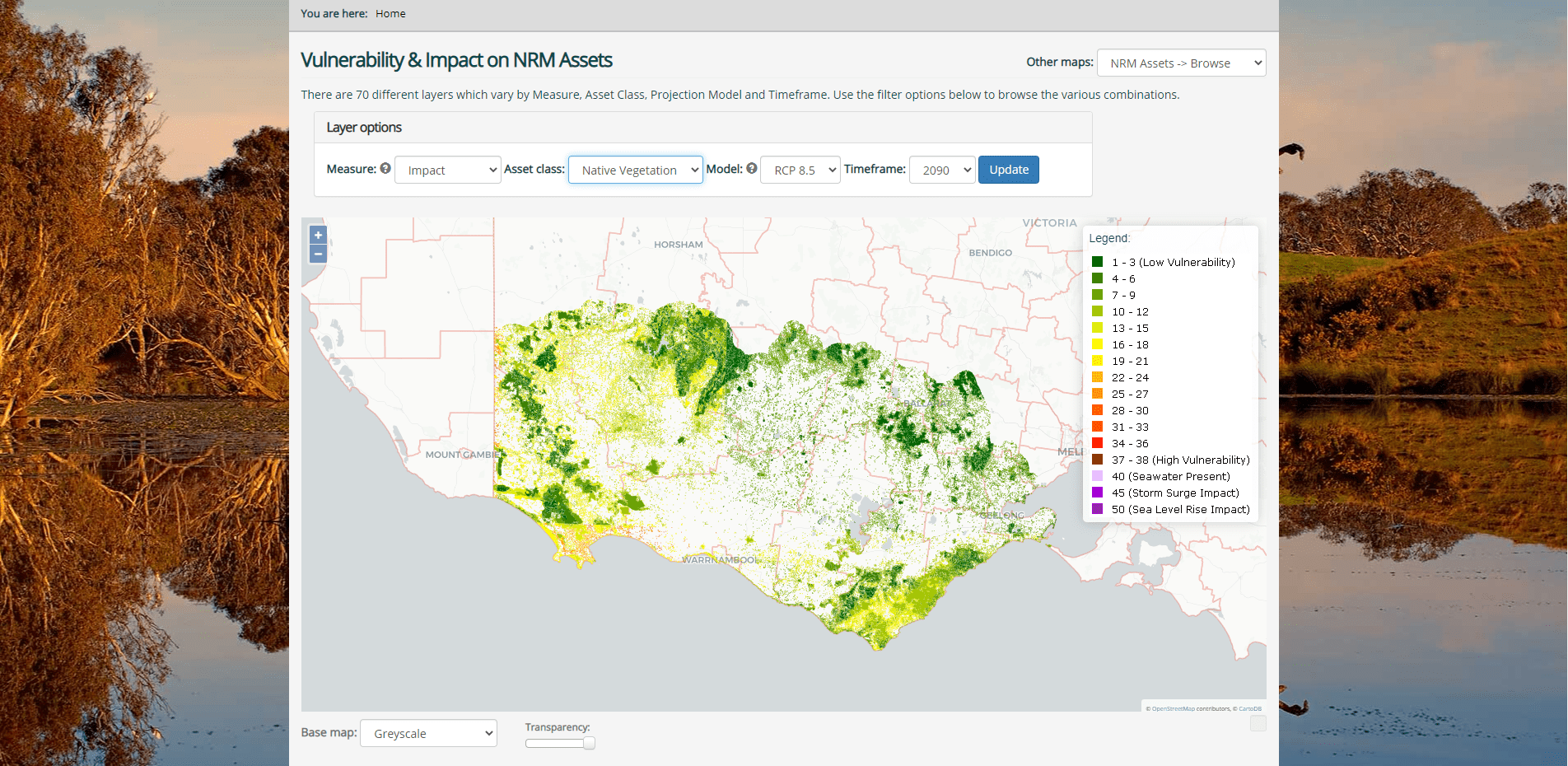
The South West Climate Change portal provides regionally specific information to support NRM planners, land managers and community groups adapt to a changing climate.
![]()
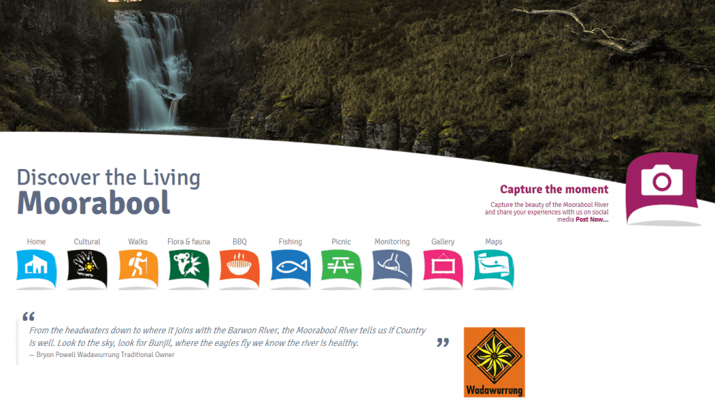
Discover the rich cultural history, beautiful waterfalls, walking trails, picnic and fishing spots of the Living Mooraboolte.
EstuaryWatch is a successful citizen science program that supports community members to monitor the health of their local estuary.

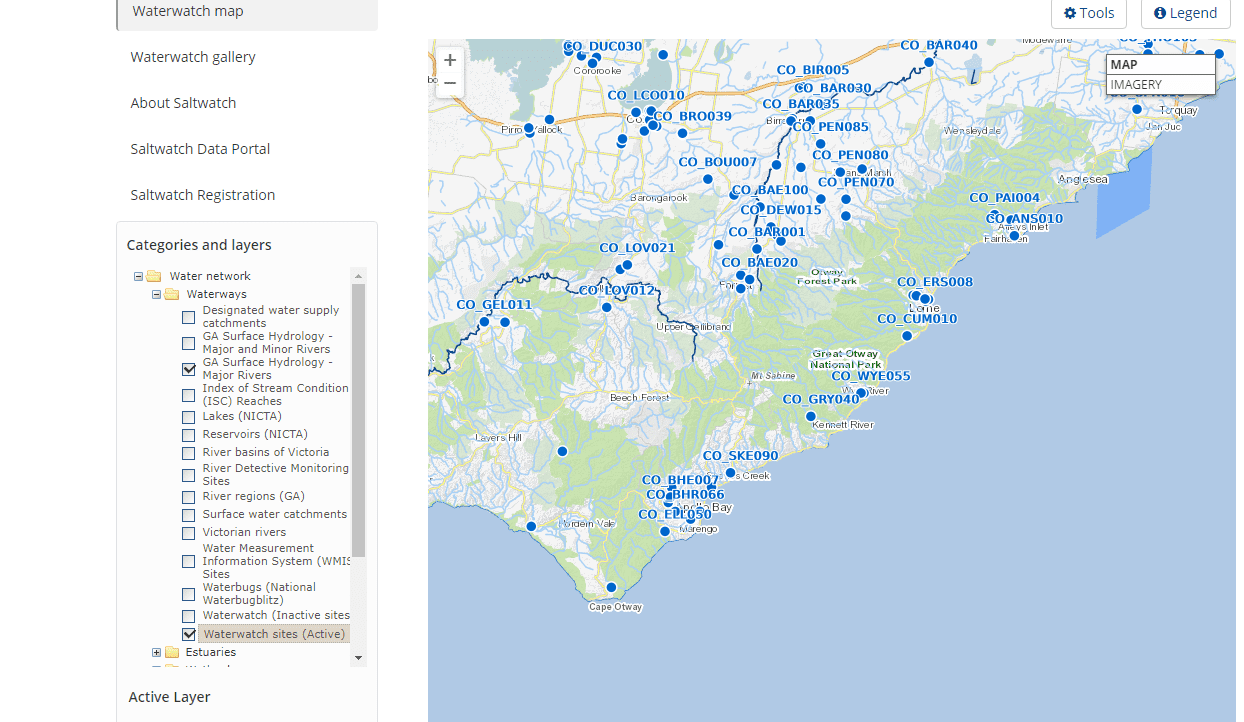
Waterwatch Victoria has connected local communities with river health and sustainable water issues and management since 1993.
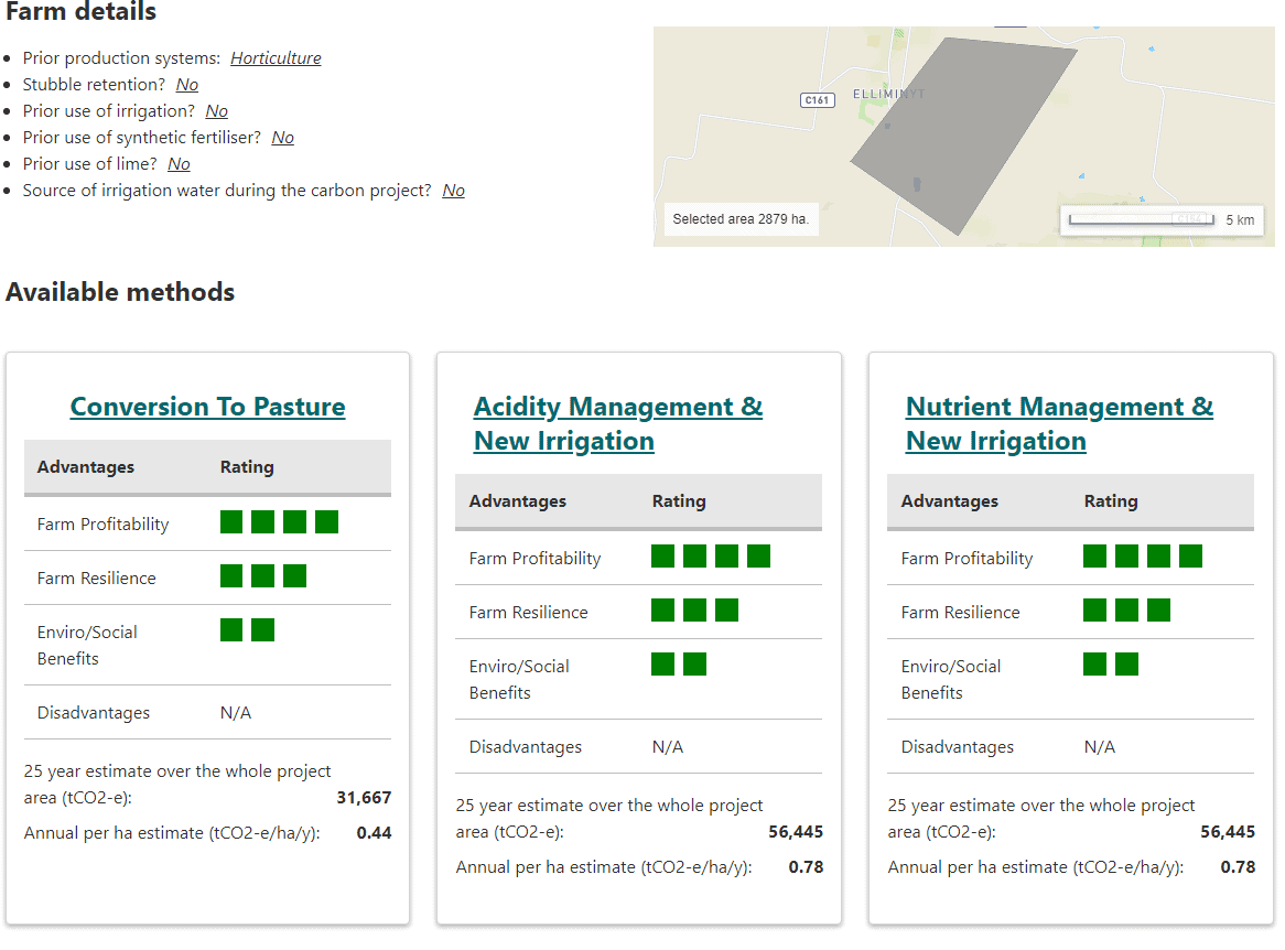
LOOC-C (Landscape Options and Opportunities for Carbon abatement Calculator) allows you to quickly assess options on the land for certain projects offered under the Emissions Reduction Fund (ERF).
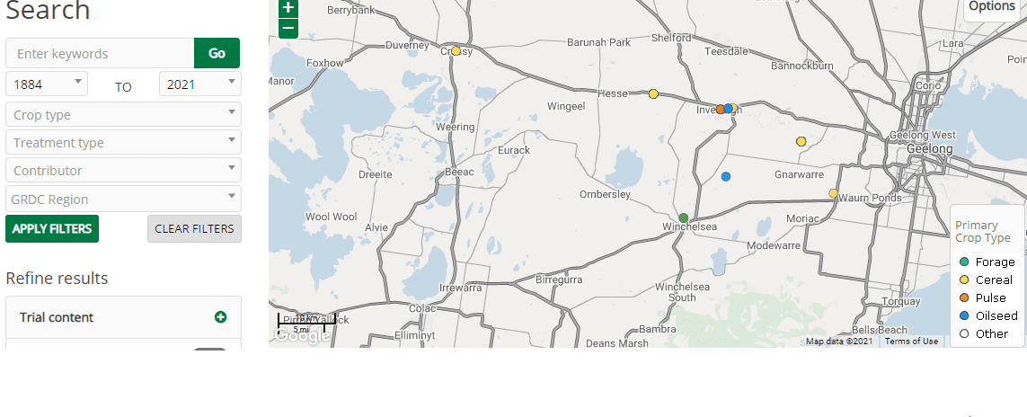
Online Farm Trials is an exciting initiative that brings nationwide grains research information directly to the grower, agronomist, researcher and the wider grain industry through innovative online technology.
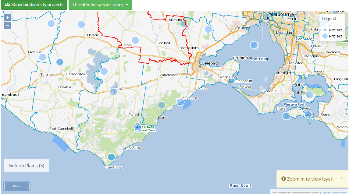
Visualising Victoria’s Biodiversity is a central access point for Victoria’s environmental datasets from government agencies, organisations, community groups and individuals.
VVB is a partner site to SWIFFT.

The State-wide Integrated Flora and Fauna Teams (SWIFFT) site connects people interested in threatened species, biodiversity conservation and citizen science across Victoria and south-eastern Australia.
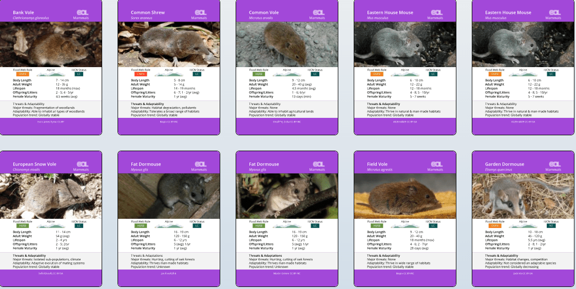
Encyclopedia of all 1.8 million named species of animals, plants, and other forms of life on Earth.
An initiative of The Field Museum of Natural History, Harvard University, Marine Biological Laboratory, Smithsonian Institution, and Biodiversity Heritage Library.
Visualising Victoria’s Groundwater is a central access point for Victoria’s groundwater datasets, including 2D and 3D visualisations, hydrogeological models and historical records and maps.

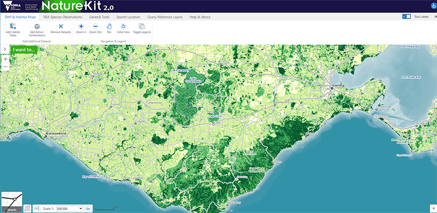
NatureKit is a statewide biodiversity web mapping and reporting tool managed by the Department of Environment, Land, Water and Planning.
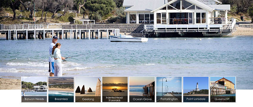
Our Coast brings together local governments and the Geelong and Bellarine Peninsula communities to plan for climate change in areas such as sea level rise and storm surge.
An online tool to help you to read the landscape and understand the native vegetation in your area, as well as how to give it a helping hand.


64 Dennis Street, Colac VIC 3250
PO Box 159, Colac, VIC 3250
Hours: 8:30am – 5pm, Monday to Friday
T: 1800 002 262
E: info@ccma.vic.gov.au
BARWON WATER OFFICES
Hours: 8:30am – 5pm, Monday to Friday
All mail must be sent via our Colac office
PO Box 159, Colac, VIC 3250
T: 1800 002 262
E: info@ccma.vic.gov.au
 Close
Close